CONFERENCE INTERNATIONALE GAGER’22
From September 19 to 23, 2022
Salle de Conférences de la FALSH et CDTIC
Co-organized by the University of Ngaoundéré, the GMES and Africa Program of the African Union and Local Development Support Organizations under the theme :
GEOMATICS, LAND USE PLANNING AND RESOURCE MANAGEMENT IN TROPICAL ENVIRONMENTS: ISSUES, CHALLENGES AND PROSPECTS OF DISTANCE TRAINING
Avec la participation de Camair-Co, transporteur officiel de la conférence
Scope of the conference
Since 10 years, the GAGER master has prepared students for careers in land use planning, national security and the management of resources based on geographic information.
Graduates from this training, directly operational, are able to adapt to a wide variety of structures: decentralized local authorities, environmental impact and management studies offices, research institutes, national army, development of the territory, town planning, ….
GMES and Africa est un programme de l’Union Africaine qui vise, avec l’appui de l’Union Européenne, plusieurs objectifs parmi lesquels : la Promotion du développement en Afrique des capacités locales, des ressources institutionnelles, humaines et techniques pour l’accès et l’exploitation des services basés sur l’Observation de la Terre sur une base opérationnelle pour le développement durable. Cet objectif constitue la mission principale du Master GAGER qui, chaque année, forme avec succès des dizaines d’étudiants originaires des cinq sous-régions économiques de l’Afrique et même hors de l’Afrique.
The hybrid international conference that the GMES and Africa Program is co-organizing with the University of Ngaoundéré from September 19 to 23, 2022, on the latter's campus in Cameroon, is an opportunity to take stock of these 10 years of the Master GAGER in open and distance training, to share the results and set new directions, in connection with Earth observation, for this training at the service of the development of Africa in particular and the world in general.
The session below underlie the issues that will be addressed during this meeting.
Session 1. Geomatics and land use planning.
Session 2. Geomatics, resource exploitation and management.
Session 3. Digital technologies and higher education.
As an epilogue to this International Conference, a training course open to young African teledetectors will be organized on 19 septembre, 2022. On September 20, 2022, a round table that will bring together specialists from various backgrounds, in order to discuss the question of FOAD , MOOCs and their integration into teaching curricula, online teaching and learning platforms made available to teachers and learners by universities wil be organinized at the opening of the Conference.
Sous le haut patronage du Ministre d’Etat, Ministre de l’Enseignement Supérieur

Professor Jacques FAME NDONGO
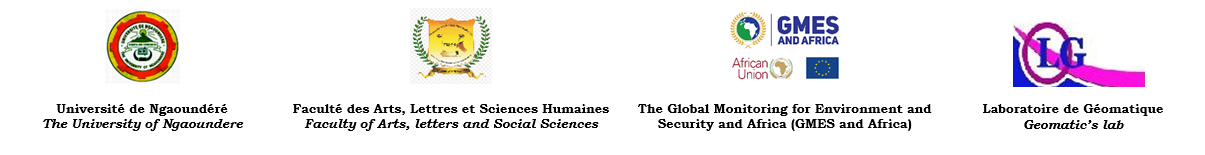
Speech by the Rector of the University of Ngaoundéré
Professor Florence UPHIE CHINJE
Lire l’allocution de Mme le Recteur…
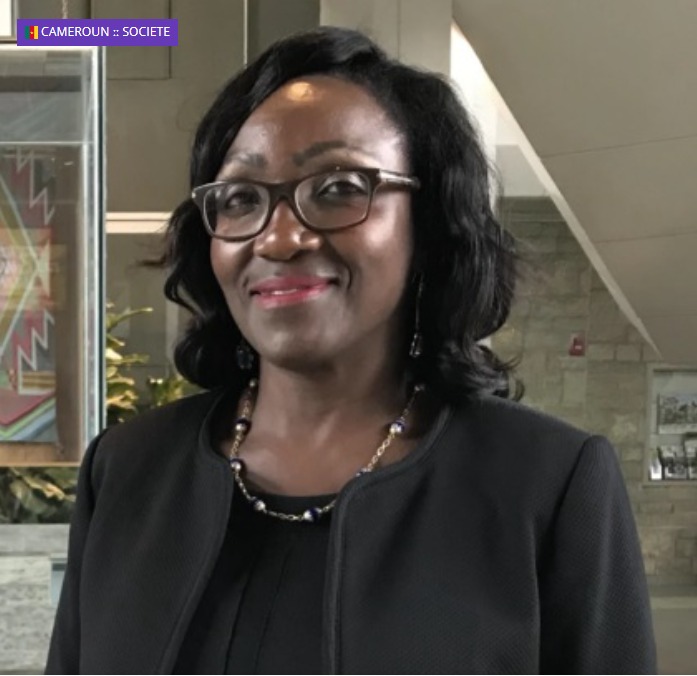
Message from the Dean of FALSH
Professor Jean NZHIE ENGONO
Read the words of Mr. le Doyen
Speech by the Coordinator of the GMES and Africa Program of the African Union
Doctor Tidiane OUATTARA
Lire l’Allocution…
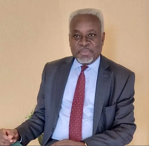
Argument of the Scientific and Pedagogical Referent of the MASTER GAGER
Professor Michel TCHOTSOUA
Our partners
Agence universitaire de la francophonie
Société de développement du coton du Cameroun
Centre de coopération internationale en recherche agronomique pour le développement
CAMTEL
ZEN Hôtel
Société de presse et d'éditions du Cameroun

CAMRAIL
Fonds Spécial d'Equipement et d'Intervention Intercommunale
African Association for Remote Sensing of the Environnement
Institut de recherche pour le développement
Cameroon Airlines Corporation
BET Geocompetence
Hôtel VINA Palace
How to participate?
Lieu : Salle de Conférences de la FALSH & CDTIC, Université de Ngaoundéré, Cameroun.
Date: From September 19 to 23, 2022
MAIN TOPIC : Geomatics, land use planning and resource management in tropical environments : issues, challenges and prospects of distance training
NB : NE PEUT PARTICIPER A LA FORMATION QUE CELUI QUI S’EST PREALABLEMENT INSCRIT. C’EST GRATUIT.
